
Hiking the John Muir Trail - A Journey Thru the Beauty of Nature
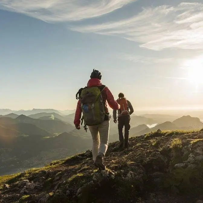
In 2019 I had the dream of going on a hiking trip, an adventure out into the mountains,
and I found out about the John Muir trail, located in the heart of the Sierra Nevada
mountains in California and considered by many one of the most beautiful hikes in the USA.
It is about 210 miles long or 340 kilometers, starting from Yosemite National Park,
then continuing south, staying high a large portion of the time at 10,000 feet or 3,000
meters of elevation, and the cherry on top, it ends on the top of Mount Whitney,
the highest peak in the contiguous USA. I know that sounded like a great adventure,
but to add to that, the winter of 2019 had record level high amounts of snowfall.
Yeah, there was still a lot of snow out there, even in the middle of July,
but more on that later. For now, let's start from the very beginning.
Arriving in the beautiful Yosemite Valley, I couldn't help but notice all the waterfalls
flowing with water from the melting snow, and of course, the famous granite walls
of El Capitan and Half Dome. After I picked up the hiking permit, I arrived at the campground
and put all my food into the bear canister, which is required for the entirety of the trail
to prevent bears, or mostly marmots, from getting into your food. And then I set up camp,
and I was ready to start the journey in the next morning.
Starting off with five days worth of food on the back, I was excited to finally get going.
Yosemite Valley is the lowest point on the entire hike, and the trail quickly climbs out
of the valley passing by Vernal Waterfall, and then Nevada Falls, with water falling from almost
600 feet, or 180 meters. Instead of continuing on the John Muir Trail, I wanted to make two
side trips that day. One, to get to the top of Half Dome, and if I still had the time after that,
to hike to Cloud's Rest, famous for its view of the Yosemite Valley.
On the way up to Half Dome, I hid my backpack in the forest, in order to be lighter going up the
cables. These cables were constructed to make it safer to go up and down the sleek surface
without any rock climbing equipment. It was still pretty challenging, especially because I didn't
have a neck strap for the camera, so it meant that I only had one free hand to hold and to
pull myself up the cables, but it worked out in the end. I wanted to make my second side trip
and continue towards Cloud's Rest, but instead of descending back down to the John Muir Trail,
and then going back up again, to save time, I decided to go off trail and maintain the same
elevation. After crossing over some fallen trees, I made it back on the trail heading up to the peak.
I'm feeling the altitude already here.
On top of Cloud's Rest, I was feeling both accomplished and very tired.
That first day had the most elevation gain than any other day.
So after a much necessary break on the top and enjoying the views,
it was finally time to find a place to camp for the night.
The plan for this day was a lot more metal than the previous.
With no peaks to climb or major passes to go over, the plan was just to get back to the
John Muir Trail and hike down to the Tuolumne Meadows. So normally the trail goes down and up,
but I'm planning on taking a shortcut here. So instead of going all the way around and then
just straight, it's a beautiful section. I have Cathedral Peaks over there,
and now I just got to find a way down. After about 40 minutes of hiking off trail,
I just had to cross this creek and I was again back on the John Muir Trail.
On the way to the campground, I passed by this mineral water spring,
which has carbonated water coming out of it, and apparently the water that's coming out
tastes just like soda. Wow, it does taste like soda.
Here I also had my first taste of the mosquitoes, or more like they had the first taste of me.
So I just ended up eating dinner protected inside of the tent.
From Tuolumne Meadows, the trail continues in the green Lyell Canyon,
with Lyell Fork River flowing quietly by the trail. And after some climbing out of the meadow,
I crossed the river and continued towards Donoghue Pass.
Here for the first time, I ran into these snowcapped fields. Walking through snowcaps
can be a fun challenge, and having trekking poles definitely helps with keeping the balance,
but it was just a lot slower than walking on a regular dry trail.
Just below Donoghue Pass, I made it to a very rocky and snowy area,
without a place to pitch the tent. So I decided to cowboy camp,
which means camping without a shelter. So hopefully it's not going to be too cold,
doesn't look like it's going to be any rain coming tonight.
As the sun was setting, another hiker joined in. He had been hiking in the opposite direction,
and as we had dinner, we chatted about what was ahead. The snow conditions,
river crossings, snow gear. It sounded like there might be quite a few challenging sections,
but sleeping under the stars, I was very excited for what was ahead.
Early in the morning, in the high elevation, it was still pretty chilly,
so I stayed in bed until the sun came out, and then headed towards Donoghue Pass
and the many lakes along that section of the trail.
I started the hike without any snow gear, and I saw that most of the PCP hikers going north
had microspikes and ice axes. So I asked them if it would be a good idea to buy some snow gear
when I get to the next town to resupply. Do you think I should buy microspikes in Mammoth?
Yeah, absolutely. Yeah. You need microspikes and an axe. Alright. Yeah. Yeah, you should. Good idea.
I guess this is the section where people were saying to be careful, because if you fall off,
you might slide down all the way to the lake. So hopefully not falling.
Camping near water meant there were a lot of mosquitoes. Luckily, I had my head net,
and to stay sane, I also put on my rain gear and set up camp for the night.
On day five, there was not much hiking, because I was finally heading into a town.
Nice one, fancy boy. Wet balls.
There were other, more dangerous river crossings ahead, but this one at about
crotch high was the deepest. The trail passed by a Red Smedle resort, from where we took the
bus down to Mammoth Ski Resort, which was still open for skiing in the middle of July.
And finally, I was in town. Bought the microspikes for the snow,
ordered some burritos, and made it to the hostel with a nice comfy mattress.
After a night in civilization and resupplying, it was time to get back into nature and on the trail.
This area had a lot of burned down trees from a fire,
yet the ground was covered with new life starting and blossoming flowers.
This day had mostly meadow uphill through forests, staying close to the treeline,
and providing a nice shadow in the hot and dry Californian climate.
By day seven, you kind of get used to that new morning routine,
of waking up with the sun, breaking camp, and heading back on the trail.
The approach to Silver Pass had a boot track on the steep section,
but after chatting with a PCT hiker, he recommended that I follow the actual trail,
which goes around without such a steep climb. So I followed his advice and went around,
and in the end made it to the final straight line up towards the pass.
As I was hiking, I met Ryan, who was also a JMT hiker.
We had a similar hiking speed and we vibed well, so we started hiking together.
And generally, it is also safer to hike with a company,
especially if going through some more dangerous sections.
The trail passes nearby Lake Edison, and on the other side of the lake
is the small resort called for short VVR, to which hikers can send their resupply boxes.
So we got on the ferry to the resort, and I picked up the package I had sent,
with food and supplies that should keep me going for the next seven days.
The next day, we got back on the ferry and continued going south.
It was interesting to notice how on one side of the mountain,
everything was much drier, with less vegetation,
and on the other side, it was lush green with cooler temperatures.
Bear Creek had a very strong flow, and to cross it,
there was a spiky and very slippery fallen tree.
This for me was the most dangerous river we had to cross on the entire trail.
Arriving in the beautiful Murray Lake, and after dipping our feet,
I couldn't resist the temptation and had to jump into the frozen waters.
Here you can see how vicious the mosquitoes have been so far.
Starting from Murray Lake, we were pretty close to Septim Pass,
and even though there was still some snow, the climb was pretty mellow.
The trail was passing nearby Muir Trail Ranch, which is another famous resupply point,
and even though I didn't send a package there, I still wanted to check it out.
They had a hiker box, or more like a dozen of boxes, full of food
and other items left from other hikers.
Muir Ranch was very nice, and now back towards the trail.
After passing by Muir Trail Ranch, the backpack was at its heaviest
because there were no other places to resupply for the next 77 miles, or 120 kilometers.
Entering Kings Canyon National Park, there was another major river crossing ahead,
namely the Evolution Creek.
Evolution Creek waterfall, running like crazy.
And thankfully there was an alternative and safer route to cross it,
where the water has a much slower flow in the middle.
The mosquitoes were truly abundant in that area,
and I had to put some extra clothes and a head net to stay protected from them,
and soon I found a camp spot and joined a group of Boy Scouts where they had also set up camp.
Passing by a ranger station, there was a note from the ranger
saying that there was still a big snowy section near Muir Pass,
but to get there first we still had some distance to cover.
There were some PCT hikers sitting by the lake,
and we joined them for a quick lunch break and a skinny dip into the cold water.
We enjoyed a nice break by the lake, but it was time to start heading towards Muir Pass.
And here we saw that there was indeed a long snow section ahead of us that we had to go through.
It is now three in the afternoon, so the snow is pretty slushy.
It's okay.
You made it, man.
Field repair worked.
You got it.
Nice.
Feet are getting quite a bit more tired, because the legs and the feet are using so many more
small muscles to keep the balance and to push off the snow.
Surrounded by this beauty and moving forward,
Muir Pass was getting closer and closer until we finally stepped out of the snow.
The question is if we should sleep here or continue down.
Yeah, it's so beautiful.
It was getting late, and even though not recommended,
we ended up sleeping in the shelter with nine hikers in total.
And after such a long day of hiking, nature gifted us with this colorful sunset.
It looked like there was still a lot of snow on the other side of the pass,
so I decided to put the microspikes into work for the first time.
The snow was already getting slushy, and coming to the first dry patch,
I just threw the microspikes out.
I continued without them.
I saw some hikers were glissading, but I just wanted to keep my butt dry,
so I just went to the dry rocks instead.
Just gotta be a little careful with the loose rock.
Seeing a coyote for the first time, I didn't know what to expect,
so for the next 5-10 minutes, I just kept checking and looking back to see if it wasn't following.
The trail then continues to a section called the Golden Staircase,
which is a steep series of switchbacks on the way up towards Mother Pass.
I go up today, but I still have to climb tomorrow, so that's good.
I saw this flat spot on the rock and decided to cowboy camp once again.
As I was gaining elevation and getting closer towards Mother Pass,
the snow was again becoming more prevalent.
Hello.
Hi.
Heading down, the other hikers had told me about some loose rock and sand
where I had to pay some extra attention to.
Yeah, so I might have to just go very careful down this.
Back on trail.
With Mother Pass behind, I was heading down into the next valley
before beginning to climb up again towards the next pass.
Just gonna go through the alternative.
I saw a note from the ranger about a safer alternative crossing,
going through multiple smaller creeks in the meadow
instead of one that's bigger and more dangerous down below.
Nice.
This is where the trail normally crosses.
Yeah, not a good idea.
Coming to the original crossing, I was again back on the trail
and started heading up to get closer towards Pinchot Pass.
Finding a camp spot by the lake, the ground was pretty rocky,
so I ended up just cowboy camping once again.
From all the wet feet and river crossings, my feet are pretty, pretty soggy.
The water was cold in this lake.
There is ice in it.
I'm gonna sleep very well tonight.
Morning, mister.
How are you?
Did you eat some of my stuff?
So often on this trip, especially around the passes,
it's been just make your own adventure,
find your own path until you find the trail.
And then it's nice and easy from there.
And back on the trail.
Going down towards the valley, the trail transitions from rocky and snowy
to being filled with more plants, trees and streams.
Nice and shaky.
After crossing the bridge at the valley floor,
the trail then starts going up towards the popular wilderness area around Ray Lakes.
I arriving at Ray Lakes, I met back with Ryan.
What's going on, man?
We made it to Ray Lakes, man.
Ray Lakes, baby.
Finally, man.
It's so beautiful.
Feeling revived, man.
After a quick dip in the lake,
it was dinner time both for us and for those hungry mosquitoes.
It was very nice meeting you.
You too, man.
I had a lot of fun hiking with you.
We said our goodbyes with Ryan because I had to go off trail to resupply
while he had enough food to continue until the end.
I enjoyed my breakfast at Ray Lakes and headed out towards Glen Pass,
which other hikers were saying was one of the more challenging passes on the trail.
The trail goes to a certain point and then there is a scramble up to the rocks
and then it gets to a little snowy traverse there.
Okay, I think it's around here where the sketchier part begins.
A little bit of rock and snow scrambling.
I think a lot of the sketchy scramble is finished.
There's the last traverse here, the last section.
Nice to secure with every step.
Soon after Glen Pass, I made it to the Kearsadge Pass Junction
From here, I had to hike out off of the mountain
in order to get to the nearest town to resupply with food for the final section of the trail.
So I headed out towards the town of Independence over Kearsadge Pass.
And at first, it was not fun to know that you gotta be doing a 15 mile or 24 kilometer round trip
just to get some food.
But in the end, you gotta accept it and enjoy the views.
And when I was least expecting it, I received my first ever trail magic.
Wow, thank you.
A big morale boost as well as a ride down to the town of Independence
where I stayed at the Courthouse Hostel.
The post office opened at 9.30 and I picked up the package with food
and I started hitchhiking and got a ride up to the trailhead.
All right guys, thank you so much.
It's gonna be a long day.
And with somewhat of a late start, I began hiking again back towards Kearsadge Pass.
I arrived back at the junction where I had left and continued again on the John Muir Trail.
Much darker clouds around there.
Darker clouds filled up the skies, so for the first time,
I had to take out the rain jacket for actual rain protection
instead of just protecting me from the mosquitoes.
First day of rain from so many days on trail.
I think I still think I've been pretty lucky so far.
Right after I had set up camp, it started raining some more
but in no time, it stopped raining, the rainbow came out
and the skies began to clear up for the sunset.
Heading towards Forester Pass, the highest pass on the trail,
there was much less vegetation and mostly just rocky terrain.
Crazy foggy weather out there, but I hope it's not gonna be a big rainstorm.
It did start hailing, so I'm just trying to hide behind this rock
and hopefully the hail is gonna stop soon.
The hail stopped and I think the storm is going that way
and there's still some rain and some people coming down from the pass.
Thankfully, the storm didn't last very long
and now the only thing left to get to the pass was to cross the Snowy Traverse.
We made it!
Forester Pass!
Crazy storm, but we survived it.
Right below Forester Pass was this somewhat narrow chute
and then the trail continues carved in into the rocky face of the mountain.
With Forester Pass behind, I wanted to get as close to Mount Whitney as possible
in order to be able to hike to the summit the next day.
Let's do this!
Nice and fresh.
This part of the trail goes through Sequoia National Park,
which is the home of the giant sequoia trees.
That right there is Mount Whitney, the highest point in continental USA.
Mount Whitney is also where the John Muir Trail officially ends,
which meant this hiking trip was soon going to be over.
This was the longest day I had on the trail
and as I was nearing the campsite,
the sky and the mountains had lit up in these rich, vibrant colors of the sunset.
I arrived at the camp spot by Guitar Lake right below Mount Whitney
and set up camp for the last night of sleeping on trail.
I woke up early to have an early start of the day
because the forecast was for afternoon thunderstorms
and if I wanted to get to the top, I had to be there before noon.
The trail to the summit continues through a series of switchbacks,
gaining elevation with every turn.
For the last stretch, because I was coming back to this junction,
I left the bear canister with some leftover food to lighten up the backpack a little bit.
The first sun rays.
Continuing on the rocky trail, the summit was getting closer and closer
and the only thing left was to cross the final snowy traverse right below the summit.
Alright, right there.
Oh, it feels so good to be so close.
On top of Mount Whitney is where the John Muir Trail officially ends,
but there were still additional 11 miles or 17 kilometers of descending
to get down to the trailhead.
Sitting down to appreciate the views and to eat some snacks,
the clouds were quickly running in and it was time to start hiking down.
I looked at the high Sierra Nevada mountains for one last time
and continued hiking out towards the valley.
As promised, the rain, hail and thunderstorms came,
then it slowed down and went away.
I'm gonna miss all those trees and mountains and peaks.
After a number of days of experiencing the nature of the Sierra Nevada mountains,
it was time for this journey to end.
Alright, that's it.
The Whitney Portal.
Yeah, beautiful nature experience.