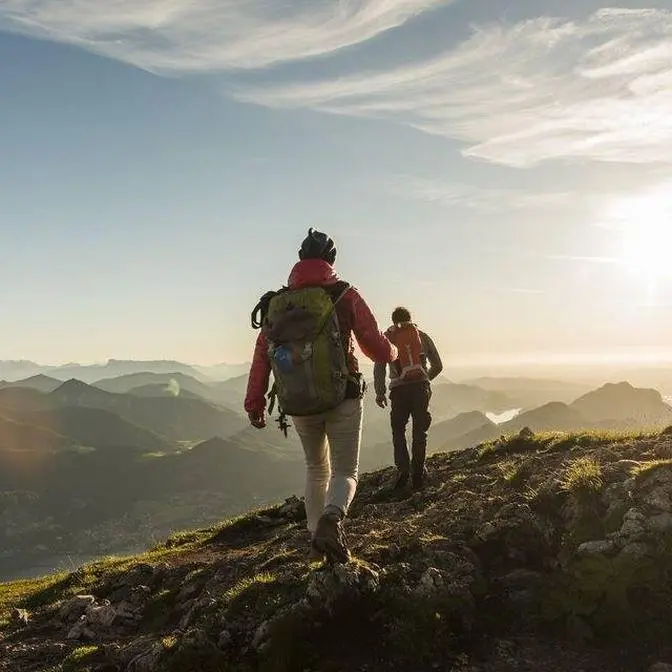
GPS track here: https://bit.ly/hochgall A few notes: 1. There is basically no real trail from Magerstein to the bottom of Hochgall, or at least I didn't see many signs. you can bring crampons and hike down the glacier (be careful) or scramble down the rocks on the side of the glacier (not fun). 2.the track goes through Rifugio Roma - Kasseler Hütte, I hiked off-trail from the bottom of Hochgall to where the river is to save some time. Not a good idea, better to hike through the hut as the terrain is difficult to hike and you don't really save time. 3. if you want to split the itinerary in 3 days, you can sleep at Kasseler Hütte - Rifugio Roma the first night, and at Barmer Hutte 2nd night. still a very long 2nd day though so keep it in mind. 4. Enjoy :-)
Hello! welcome to a new video! this is definitely the hardest and longest mountain trip I have ever filmed. A 40km 4274m D+ circuit around (and summiting) Hochgall (3436m) the highest peak in the Riesenferner Gruppe - Vedrette di Ries, South Tyrol.
Starting from Anthorzer See - Lago di Anterselva, I spent 2 days exploring this incredible area, sleeping on a very tight spot on the ridge to Hochgall (no idea how I managed to sleep) and enjoying Dolomites and Austrian Alps from a different perspective.
Hello, hello, welcome to a new adventure and welcome to Ant Hortertal, Valle di Anterselva, South Tyrol.
It's my first time here and in these next couple days I'm going to explore
the beautiful mountains around here, the area of Vedrete di Ries. I'm gonna make a two-day loop,
very hard one actually, I'm gonna try to summit the highest mountain.
Sleep somewhere in my sleeping bag. Good morning.
And yeah, enjoy some incredible landscapes. So join me in a new adventure, let's go.
The first goal is this saddle. Tiny little emergency bivouac. So nice.
Three and a half hour hiking. I just made it to the saddle with this tiny little bivouac.
Rieserfernerhitte, Refugio Vedrete di Ries. So cute.
Lunch at the hut has been definitely fulfilling. Now the plan is to keep going up
on the ridge behind me. First mountain is gonna be Fernerkopf and then the ridge
will keep going till Magerstein. 450 meters more. 150 meters to the first stop.
It's a pretty steep last part. Not the best terrain. Reminds me of Switzerland.
Check out the view on this side.
First top of the day.
Fernerkopf. 3249 meters. This is the ridge I'm going to follow. Looks incredible.
Let's keep going.
It's getting very windy. Magerstein. Kolmagro. 3273.
Look at the view over the valley. Spectacular.
Look at the view over Dolomites on the south. But we're gonna have an even better view
from our next goal. Horkal. Let's go. Let's keep going. This part was pretty sketchy.
Not fun. Definitely not fun.
So it's 5 p.m. and I'm at the beginning of the route. There's around 850 meters
to go up. So I'm pretty sure I can make it. There's like three hours from here to sunset.
So yeah, I think it's doable. I'm a little tired of course. I hiked like 2 000 meters
up. But I feel fresh enough to get to the summit. So let's go.
How incredible is this mountain. It's just unbelievable.
So as you might have understood, I decided to stop here because the top was still quite far.
I was quite tired and I actually love this spot. So I wanted to catch the last light of the day
with this incredible face. So there's still one, one and a half hour to reach the top.
I will do it tomorrow, very early in the morning. I also found a place to sleep. I'll show you
down there. It's quite tight but seems quite comfortable. I have a sleeping bag
and bivy bag, nothing else. Today has been a really long day. Like somewhere around 2500 meters
elevation up. I'm tired. But I can't wait for tomorrow. Tonight I have a spoon. Incredibly.
This is by far the most uncomfortable camping spot I've ever slept in. I'm laying on rocks
with no mattress and I'm going downhill. So that's not the best but it's more than enough.
See you tomorrow morning. I slept. I don't know how but I managed to have rest.
It's around six in the morning. Should be summer's time but there must be some clouds
on the horizon. I don't see any light coming. Amazing. Let's keep going.
I'm on the final ridge.
What a view. Dolomites.
It's time to go down. It's super windy. I'm down but the tour is not finished yet.
Not at all I would say. So let's make a little recap. I arrived from over there. I went on top
and now the idea is to go all around Horkal and get back to where I started, to the lake.
I'm gonna get a trail that goes all around this sort of ridge and then I will go up to a mountain,
down to another valley, there is a hut there, up to another saddle and down to the lake.
It will be long. Right now it's like noon so I hope I will make it by sunset. I don't know. We'll see.
I'm back on the trail. This valley is just incredible. I wonder how the glacier was like
some years ago. It must have been so different.
Look at how huge these valleys are. It's so different from what I'm used to. This trail
actually keeps going and traverses the entire face. It must be spectacular but I'm not gonna do it.
The plan is to go up to that mountain and go down on the other side.
So the sign says Lengstein Sharte 2 hours 20 minutes. It is a long way. It's around 1000
meters up so I need to be fast otherwise I won't make it in time by sunset. So yeah I will just
see you up there in a little bit. This path is for sure one of the steepest I have ever hiked.
Crazy. Lengstein, fifth and last top of this tour.
So little recap of the tour. First three tops up here, one, two, three, then all the way down
up to Hochgall, down again, circled around, up here and then
fifth peak. It's time to go down now. Road to Barmerhütte. I have to go
over there, then up to the saddle and then other side.
All the way down. At this stage of the hike I feel like my legs are just hiking on themselves. I'm
even controlling them. I'm thinking about nothing and legs just hike.
Wow. Saddle.
Wow. Dolomites on fire.
Dinner time. Pizza. I am completely exhausted. Good night.
Hello hello Bruno from the future basically. Four months later. This video was actually shot in
late August so it was probably time to release it. This trip was probably one of the hardest I've
ever done or at least ever filmed. It was 40 kilometers, more than 4000 meters elevation gain
and especially on this kind of terrain it was hard. But I'm happy because this idea came to
me while looking at all the trails around Hochgall. I wanted to summit the top but I also wanted to
make a circle around it so I came up with this track and it was pretty cool. So if you're
interested you can find it in the description. Of course it's a hard route but you can split
it in three days instead of two and it can be more doable. There are some huts on the way.
So yeah a lot more adventures are coming. I filmed quite some stuff in the last months
that I can't wait to share with you. So yeah I will see you in the next adventure.