
AFGHANISTAN: A Country on the Edge of the World | 4K Travel Documentary
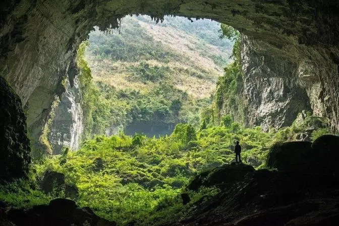
AFGHANISTAN: A Country on the Edge of the World | 4K Travel Documentary
Listen... The sound of the explosions makes you afraid to step back.
The world calls this place the graveyard of empires. But how can a 'dead land' hide architectural masterpieces that have withstood the destruction of Genghis Khan?
At a cruel crossroads where civilizations collide, armies clash, and time almost stands still, one of the greatest treasures is hidden under the dust of time.
Welcome to Afghanistan, the living legacy that the news never told.
Subscribe: / @trueglobe66
#afghanistan #kabul #ghazni #traveldocumentary #documentary #trueglobe #4Ktraveldocumentary
Afghanistan.
Listen, the sound of the explosions makes you afraid to step back.
The world calls this place the Graveyard of Empires.
But how can a dead land hide architectural masterpieces
that have withstood the destruction of Genghis Khan?
At a cruel crossroads where civilizations collide,
armies clash, and time almost stands still.
One of the greatest treasures is hidden under the dust of time.
Welcome to Afghanistan, the living legacy that the news never told.
Minaret of Jam, where no modern roads lead and no cities exist.
A 65 meter high brick tower challenges everything you think you know about this desolate place.
History tells us that when the Mongols swept through the region in the 13th century,
they wreaked such havoc that they wiped entire cities off the map.
They burned palaces, destroyed libraries, and massacred the population.
Yet this tower still stands as the general who ruled the land.
The Minaret of Jam stands tall in the remote mountains of Gor.
The only remaining relic of a lost capital once called Firozko, the legendary Turquoise Mountain.
Built around 1190, the structure narrows as it rises, enveloped in spirals of Kufich
and Nash calligraphy, geometric bands, and glazed tiles that still catch the light eight centuries
later. Each line of tile is so carefully crafted, so meticulously crafted, it almost defies vision.
If only its builders had anticipated the time and conquest that would come.
Today it is a UNESCO World Heritage Site, but it is teetering on the brink.
Threatened by the Hari River erosion and earthquakes, the leaning tower fights daily
for survival. Kabul. The next moment you are pulled into a quagmire of noise, dust, engines,
markets, and movement that has piled up over three millennia of conflict and recovery.
Kabul, the capital of Afghanistan, fondly known as the funnel of all history.
Situated in a deep mountain basin, a natural funnel through which every empire,
every migration, every war, and every rebirth has eventually flowed.
At 1,800 meters above sea level, the city has seen armies march through the Khyber Pass,
witness kingdoms rise, fall, rebuild, and fall again. For more than 3,000 years,
Kabul has been a spoil of war, a crossroads, a frontier of clashing cultures.
Here Alexander's scouts once camped, where Ghaznavids and Mughals mapped their power,
where the British, Soviets, and Americans came and left their mark on the same land.
Kabul bears these layers openly. The city does not hide its scars.
Bamiyan Valley offers one of the most direct connections to Afghanistan's Buddhist past,
a chapter of history that has been obscured. Located at nearly 2,500 meters in the central
highlands, the valley was once a busy stretch of the Silk Road, where monks,
traders, and travelers traveled between South Asia, Persia, and China. Its location made it
a natural hub for the exchange of ideas, and Buddhism gained a foothold here for nearly a
millennium. Bamiyan's most recognizable features are two colossal Buddha statues carved into the
sandstone cliffs in the 6th century. Rather than being built from prefabricated blocks of stone,
they were carved directly from the cliffs, surrounded by hundreds of caves used for
meditation, teaching, and painting. Fragments of murals influenced by Indian, Persian,
and even early Chinese styles illustrate the area's past connections. The destruction of the
valley's most visible symbols, but not its cultural significance. For archaeologists,
the surrounding cliffs still hold vast monastic complexes, unfinished sculptures, and layers of
art left over from previous conflicts, including Mongol invasions in the 13th century.
Bande Amir. West of Bamiyan, the landscape changes almost without warning.
Water appears clear, deep, and completely unexpected in an area that has long suffered
from drought. Six narrow valleys contain six lakes, each nestled between white limestone walls
and glowing turquoise in the highland light. The landform is called Bande Amir,
the Commander's Dam, a name that comes from a local story that Imam Ali struck the cliff
and opened up the basins overnight. Legend has quickly filled in the gaps that geology
cannot explain. The cliffs of Bande Amir appear as a purposefully carved natural architecture.
The white limestone bands are stepped, curving along the valley's edge, creating sharp contours
that look as if they were cut by a surveyor. Some sections resemble walls, others resemble
dam faces, though all are formed by a process of mineralization that has lasted thousands of years.
Shahre Goljola. Rises like a steep, bare hill in the eastern part of the Bamiyan Valley.
Its location was chosen for its observation. From the steps above, the view extends over the
entire Silk Road caravan corridor. The ancient city's layout is still clear, multi-tiered walls,
storage rooms carved into the slope, and traces of defensive platforms arranged in the direction
of what might have been an entrance. The site's history is tied to a moment in 1221,
when the Mongols captured Bamiyan after a long siege. Contemporary records describe a direct
order given after the death of a Mongol commander in the fighting. The retaliation was widespread
and left the hilltop settlement abandoned. Today, the wind blows freely through the cracks
in the structures. The sound it makes is sharp, amplified by the narrow alleys between the
remaining walls. This feature has led to the modern name City of Screams, although the origin lies
in the acoustic conditions rather than folklore. Shah-e-Zohak. A city was formed right next door.
Shah-e-Zohak was positioned to control the narrow corridor that once carried merchants
and military convoys between Central Asia and the Afghan plateau. The name Red City
comes from the iron-rich clay used to build the walls, a material that gives the fortress
its distinctive crimson hue when illuminated by the late afternoon light. Shah-e-Zohak was
Bamiyan's first line of defense. During the Mongol invasion in the 13th century,
the fortress held out long enough to force the attackers to besiege it. The effects are still
evident. Collapsed sections of walls, blackened stones and cracked parapets mark where the outer
defenses failed. Any entrance to Bamiyan must pass directly beneath these red walls.
The Herat Grand Mosque stands in the heart of the old city with a clear beauty that contrasts
sharply with the rolling hills of Bamiyan. Built and rebuilt over nearly nine centuries,
the mosque reflects the dynasties that shaped Herat into a center of art and learning.
However, its identity is defined by its surface. A complete shell of blue-glazed tiles arranged in
precise geometric order. The four eyewands surrounding the courtyard form the central
axis of the mosque. Takht-e Rostam defies the conventional logic of Buddhist architecture.
Its stupa is cut into a single block of bedrock, an inverted design more reminiscent
of a quarry than a temple. A stupa is chiseled downwards, completely concealing its outline
and historical secrets. At its center is the stupa, carved from the same bedrock that surrounds it.
A narrow slope descends in a controlled spiral, leading you into a room that feels purposeful
in every direction. The walls are smooth, punctuated only by light sockets and traces
of early plaster. A network of caves extends into the mountainside outside the circle.
Some contain soot from later occupations. Other caves still bear faint traces of their earlier
religious use. The site later acquired a second identity through Persian epic poetry. Its modern
name, Takht-e Rostam or Throne of Rostam, associates the holy site with the hero of Shahnameh.
Registan Desert. Between Helmand and Kandahar, the terrain gives way to one of Afghanistan's
least known natural regions, the Registan Desert. Here, the soil turns red, the horizon expands,
and the land settles into undulating dunes. The color, rich in iron and scorched by the sun,
gives the desert an unusual vitality. Clumps of mud-brick houses, a traditional technique
of the Pashtun and Baluch people, now lie scattered across the Red Earth,
separated like empty boxes pushed from their original positions by time. The settlements
of Registan were abandoned as the desert spread in the 20th century, swallowing up farmland
and water sources. With no trees or mountain shadows to stand on, only isolated sections
of wall stand, enough to give an idea of the scale of a community that once relied on livestock
and trade routes along southern Afghanistan. Siakho. Here, dormant ruins and red soil
give way to shady slopes. Siakho, meaning Black Mountain, is a mountain range stretching through
central Afghanistan. Marked by dark rock and nearly inaccessible terrain, the steep slopes,
made of ancient volcanic and sedimentary rocks, give the entire range a much heavier and rougher
appearance than the softer branches of the Hindu Kush. Narrow valleys and deep ravines
crisscross the range, creating a network of terrain that forced ancient routes to skirt around
or skirt the edge of the rocks. The harsh climate reinforces the sense of isolation,
deep cold winters, hot, dry summers, and few surface water sources. For the communities
living around the area, Siakho has acted as a natural wall, separating valleys and defining
the routes of caravans for centuries. Nuristan. The mountain valleys between Nuristan and eastern
Nangarhar form one of the most distinctive landscapes in Afghanistan. The steep slopes
from the valley floor are covered with dense cedar and pine forests, blocking out much of
direct sunlight. Below these villages, terraced fields stretch down to the river. Each narrow
terrace, edged with stones from the mountain ranges above, forms small plots of land growing
wheat, walnuts, apricots, and green rice. All of this creates a poetic natural picture that makes
anyone want to enjoy the space to the fullest. The rivers in this area flow very quickly. Fed by
melted snow, the water remains cold even in midsummer, forming deep channels through the
valley floor. Before the late 19th century, the region was known as Kafiristan, a collection
of isolated communities that maintained pre-Islamic traditions until modern times.
Its long isolation from the Afghan lowlands created cultures with distinctive languages,
unique to the local people. Blue Mosque of Mazar-i-Sharif. The Blue Mosque dominates
Mazar-i-Sharif's central square, almost entirely covered in turquoise and cobalt tiles.
As the light changes throughout the day, the tiles move through a spectrum. From pale mineral
blue in the morning to deep saturated tones near sunset, making the structure look different
from hour to hour. The site is tied to a long-standing tradition as the burial place
of Ali ibn Abi Talib. While this claim is disputed, this belief has shaped the mosque's
status for centuries. Pilgrims come here year-round, but the courtyard is especially
lively during Nowruz, when thousands gather to perform rituals marking the new year.
One of the most recognizable features is the flock of white doves that inhabit the gardens and roof.
Their uniform color has led to stories that the birds turn white when they fly into the
sacred area, although there are many criticisms about this image. People still believe that
there is a sacred power here that protects the church and the city. Salang Pass connects northern
and central Afghanistan, running through one of the narrowest and most complex stretches
of the Hindu Kush. At an altitude of more than 3,400 meters, the road hugs the wind-worn slopes
before leading to the Salang Tunnel, the most important highland tunnel ever built by the Soviet
Union in the 1960s. The terrain here does not create an open corridor, but forces traffic to
travel on narrow rocky outcrops, where each bend is obscured by the cliffs. Salang Tunnel is the
most important node. Its length of over 2,5 km allows for travel through the mountains
without having to cross the peaks, making Salang an essential link between Kabul
and the northern provinces. Mezainak is located in the mountains of Logar province,
about 40 km southeast of Kabul. The site appears as a series of low hills dotted with excavation
trenches and abandoned modern equipment. However, beneath these hills lies one of the most important
archaeological sites in Afghanistan. A thriving Buddhist city, from the 2nd to 7th centuries AD,
the settlement once contained monasteries, residential areas, workshops and temples
decorated with stucco statues and murals. The remains reveal a community that was integrated
into silk road trade, producing goods for travelers and serving as a regional religious center.
Sculptures discovered at the site reflect a blend of Indian, Hellenistic and Central Asian
artistic styles, demonstrating the cross-currents that shaped the region.
Wakhan Corridor stretches like a thin finger between towering mountains,
a strip of land straddling Tajikistan, Pakistan and China. Altitude is everything here,
villages rise above 3,000 meters, pastures rise even higher. The horizon is a series of mountain
ranges, each higher than the last, until the Pamir and Hindu Kush peaks merge into a single wall of
snow. Transport in Wakhan is slow, roads are turned into trails, used by herders to guide
yaks across the plateau. The animals move steadily, adapted to the thin air and short
grazing season. Their presence marks the rhythm of daily life more than clocks or calendars.
Stone houses are clustered close together near glaciers, fields carved into terraces,
where the soil is deep enough to hold roots. Families have lived at this height for generations,
maintaining trade routes, seasonal migrations and a way of life shaped by elevation
rather than politics. Herat Citadel
In the heart of Herat, the citadel rises from the ground with clear military intent.
The structure sits on a long ridge, with walls reinforced by watchtowers on all sides.
The layout reflects centuries of conflict and reconstruction, but the foundations date back
to the time of Alexander the Great, when the first fortified outpost was established on this hill.
The strength of the citadel comes from its shape. The walls slope inward for support,
the stairs are narrow and easy to defend. The courtyards divide the complex into controlled
areas. The entire structure was designed to control movement, who could enter,
who could leave and how far they could go before being detected.
The architecture makes its purpose clear. A single wall has shaped Herat's history over
the years. Successive kings have repaired, expanded or reinforced the complex depending
on the threats of the times. Earthquakes have reshaped some sections, while wars have left
scars in others. Yet the overall shape remains the same. A defensive backbone at the heart of a city
under constant pressure from regional power struggles.
Today, the citadel has been restored enough to understand its scale.
Walking along the ramparts, the city spreads out in all directions,
market streets, mosques, workshops and fields outside the walls.
The structure is steeped in history without embellishment.
Kar Faroshi Bird Market. In the old quarters of Kabul, Kar Faroshi Bird,
market forms a narrow corridor between the buildings that are close together.
Sounds reach your ears before colors, layers of chirping,
flapping wings and murmuring conversations. It is a separate sound space, separate from
the sound of vehicles, dust and noise of the big city. Shops line both sides of the walkway,
each displaying wooden cages stacked on top of each other in delicate patterns.
Inside are sparrows, pigeons, canaries and sometimes rare birds brought from the countryside.
The birds move constantly, creating short waves of movement
that spread throughout the market like a gentle vibration.
For many men in Kabul, caring for singing birds is a long-standing hobby.
Birds are chosen not for their rarity, but for their songs, temperaments and behavior.
Conversations here revolve around food, lineage and training techniques.
Panjshir Valley. The Panjshir Valley stretches like a vertical seam
through the Hindu Kush, cut across by a river of an eerie shade of blue.
The water flows swiftly, squeezing between the rocks,
leaving only a narrow road and villages scattered on the cliffs.
The valley has narrowed over time, creating natural choke points that have served as defensive
positions. During the Soviet invasion, armored vehicles became stuck here, restricted by the
Later, Taliban forces faced similar limitations. Panjshir did not repel armies with mystery or
legend. The landscape simply deprived them of space. Terraced fields line the low slopes,
their shape contrasting with the rugged mountains above. Stone houses sit close to the ground,
built low to withstand the winter winds that blow down the corridor. The air carries a chill
from the peaks that surround the valley. Lake Karga. Located on the western outskirts
of Kabul, Lake Karga forms a long, flat lake surrounded by low hills. Water is
collected from seasonal runoff, creating a lake that serves both a utility and a recreational
purpose. The landscape is simple, with no towering mountains, no historical sites,
a strangely peaceful nuance. The houses sit low on the slopes, built from pale earth,
almost completely blending into the surrounding hills. Their flat roofs and small windows reflect
a design shaped by climate, rather than aesthetics. Thick walls to keep in the winter,
narrow windows to soften the summer light. Walking paths run between the structures,
tracing lines worn smooth by decades of use. Darul Aman Palace. Sits on a hill southwest of
central Kabul, a neoclassical structure surrounded by straight avenues and open spaces. Its symmetry
is deliberate, an early 20th century attempt to project a modern national identity.
For decades, the building's exterior told a different story. Shattered windows,
missing roofs, and weather-beaten corridors after cycles of conflict. Photographs from the 1990s
show a structure burned from the inside, its stone shell riddled with artillery and gunfire.
The palace became a reference point for war. Restoration work began years later,
walls were cleaned, domes restored, and windows arranged in precise geometry.
Inside, vast halls once filled with rubble now host exhibitions, public events,
and administrative activities. The contrast between past and present is evident in every
restored surface. Baba Garden. Is located on a gentle slope in southwest Kabul,
a walled resort designed around water channels. Orchards and paved walkways. The garden was
founded in the 16th century by Zahiruddin Muhammad Babur, founder of the Mughal Empire,
who requested to be buried here. His mausoleum is on the upper terrace, a modest structure
surrounded by cypress trees and flowering plants. The simplicity of the tomb contrasts
with the complexity of his legacy. Water flows through narrow channels that divide the terraces,
creating a gentle, constant sound that echoes across the lawns. Families occupy shady areas
for afternoon gatherings. Schoolchildren read on the steps. Elderly visitors stroll slowly along
paths shaded by plane trees. The garden functions as a public space, but the structure beneath
remains faithful to its historic design. Musalla Complex. When approaching Musalla in Herat,
the first impression is not of what remains, but of the empty space that surrounds them.
Soaring minarets, tilted slightly by time,
stand scattered on a vast expanse of land that once housed one of the region's largest
Islamic complexes. A legacy of Queen Gahar Shah, who made Herat an important artistic center
of the Timurid dynasty. The surviving brick minarets bear a blue glaze and elaborate
geometric patterns, traces of a time when architecture was used as a statement of power.
19th century bombing and 20th century wars destroyed almost the entire complex,
leaving the towers standing apart as landmarks on the map of a city that no longer exists.
Balch is considered one of the oldest cities on the planet. So old that many civilizations have
vied to attribute their names to its origins. It is believed to have been the home of Zoroaster
and a center of Zoroastrianism before the spread of Islam.
The ancient city has a distinct circular structure. The ancient walls were built in a
concentric pattern, reflecting ancient urban planning, where defense and religious ritual
often merged into one design. While much of the wall is now just high mounds, the city's layout
is still evident in the landscape. A long clay arc that hugs modern rice paddies and small villages.
Walking into Balch is like walking through layers of history,
traces of ancient Persia, Alexander's Greece, Kushan, and medieval Islamic dynasties.
No single structure dominates the view. It's the stratigraphy and the outline of the city
that tells the story. Ghazni. In the middle of a dry plain in central Afghanistan,
two brick towers stand apart, tall and slender as needles, on flat ground. These are the minarets
of Ghazni, the remnants of the once glorious capital of the Ghaznavid dynasty, a period renowned
for its science, literature, and commerce. Both towers date back to the 12th century,
decorated with calligraphy, floral designs, and brick bands that stabilize the structure.
Although their upper bodies have collapsed in earthquakes, the remaining towers remain
remarkably straight. The distance between them is no accident. They once marked the entrance to a
large architectural complex that has since disappeared. Mahipar Gorge. Mahipar is not
a tourist attraction. It is a stretch of road that one must cross to reach eastern Afghanistan.
This narrow pass runs along a sheer cliff face, with the road hugging the rock and barely allowing
two cars to pass each other. There are no fences or dividers, just height and wind.
The cliffs of Mahipar are cut off abruptly, creating a series of sharp turns, where drivers
have to slow to a near stop to see the road ahead. For decades, this has been a strategic route
between Kabul and Jalalabad, a place where nature and man have both left their mark.
In the narrowest sections, the rock has eroded into large pieces that fall onto the road each
winter. Looking down, the Kabul River rushes between the rubble, creating a sense of space
that allows one to imagine the consequences of even the slightest mistake.
Ghazni Citadel occupies an entire mountain spur. This is one of Afghanistan's most prominent
medieval fortresses, having protected the capital of the Ghaznavid Empire
in the 10th-12th centuries. The walls are steep, many of which have collapsed.
But what remains shows a tiered defensive structure, with watchtowers, internal passageways,
and thick walls built to withstand a frontal assault. Standing on the citadel overlooking
the modern city below, one can clearly see the interplay of time. A capital that once
controlled the Silk Road, now blending into everyday life in the residential areas that
stretch around the base of the citadel. Below are the residential areas. Houses are built of
mud bricks and cement arranged closely together in a city block, dominated by long strips of
street lines. Many areas still retain the foundations of the old settlements.
Maidan Wardak Walking through the gorges of Wardak,
you will come across villages that are not built in the modern sense. They seem to have sprung from
the earth itself. The settlements of Wardak are a masterclass in vernacular architecture.
The houses, or kala, are built entirely from clay, mud, and dried straw.
Surrounding these clay fortresses are meticulously tended agricultural fields
that resemble a geometric carpet. Slender rows of poplar trees stretch skyward,
marking the boundaries between wheat and potato fields and orchards. The green of the crops
contrasts sharply with the terracotta of the architecture, creating an oasis of life in the
barren land. Alfath Mosque Located away from the crowded residential areas,
Alfath Mosque appears as a silent dot in the vastness of Wardak. Its dome and minaret tower
rise into the sky, becoming the only orientation point in an otherwise wild landscape.
The walls stand firm against the dusty winds of the plateau,
sheltering a quiet prayer space inside. Afghanistan is not a single story.
Every fragment, every place you pass, is a journey worth recording.
And they continue to hold you even after you leave. Stay with us to discover the next journeys.