New Zealand's Grave-Talbot Route is a lesser travelled hike in Fiordland National Park off the Milford Sound Road. We weren't really sure what to expect, but were excited to explore a new, beautiful area of Fiordland's rainforest.
I make outdoor adventure travel videos to inspire you to take your next trip and get outdoors. Life is short and there are so many interesting people, places and things to learn about and experience. Join me on my journey, SUBSCRIBE AND become a part of Team Infamous.
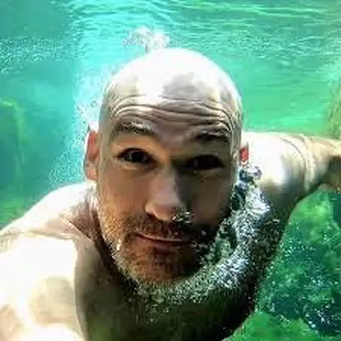
My name is Jesse St Louis (AKA Infamous JSL) and I'm an actor that likes to go on awesome adventures between gigs. I've been called a "no frills Bear Grylls" but mostly I've been called an Actor. Traveler. Smart-ass.
We've lost the trail, dense bush to get through,
the boggy sections, the leg-breaking holes.
Now, I like a good bush bash like the next guy,
but this seems like it's gonna take a long time
with no machete.
We are in Fiordland once again today
right off the Milford Sound Road
to tackle, I think, a lesser-traveled track or route,
the Grave Talbot Route.
Don't know much about it
other than every time I drive by here,
no one is pulled over by the side of the road.
It's a very infrequently-traveled track here in Fiordland,
hopefully takes us into an area
full of waterfalls and rivers and cliffs and mountains,
but honestly, don't know a whole lot about this track
other than it's very infrequently-traveled.
A lot of people just blaze out here
on the way to Milford Sound,
hit Milford Sound, and head back,
and unfortunately, you're missing out
on a lot of the beauty of Fiordland National Park,
which we will be able to show you, hopefully, today.
Very lush and dense rainforest here right off the bat.
The track is pretty slippery, mossy, and muddy,
so I could see how after some rain or during rain,
this would be pretty slippery, slippery going,
but perfect example of the rainforest here in Fiordland,
just so dense and lush due to all the rain they get.
Heavy amount of birdlife, too, so far on this track,
which is awesome.
Well, the trail, trail, I should say, in quotation marks,
has devolved into a swampy, boggy, muddy mess,
and it is slow going now at this point.
Just trying to dodge this stuff
and not end up waist-deep in this bog.
Starting to see maybe why this track is not frequently done
as we've reached a section
where it's just some markers occasionally,
but just dense bush, totally overgrown,
no signs of passage through this particular way,
so yeah, it's basically just turning into a bush bash.
More dense than Falls Creek, I would say.
We're supposed to go up this valley,
and it ends in some cliffs and waterfalls, maybe,
but I mean, this bush is pretty dense,
like a machete would be very handy right now.
All right, well, we have opted to follow this riverbed up
the rest of the way instead of where,
supposedly, the track is next to the riverbed.
It's dry, relatively easy compared to what we were just in,
so hopefully this takes us up to the head of the valley,
but much, much slower going
had we stayed in this bush over here.
I don't think we can climb any higher up on the river.
That's the bad news.
The good news is, look at this!
Woo-hoo-hoo!
Woo-hoo-hoo-hoo!
What?
I was gonna say earlier,
this reminds me of another hike we've done here
in Fiordland that's rarely done, Falls Creek.
Made a video about that one,
and this one was similar,
except there wasn't much elevation gain.
That has changed.
Now, we found the trail right alongside that waterfall
where we couldn't climb up, and yeah, steep, overgrown,
very similar vibes to Falls Creek, so, huh.
Follow the trail, the marginal trail, and then-
A route, actually, right?
Yeah, and that's a little bit bush-bashing,
and that's mostly a trail, but then you get to
where it's just completely bush-bashing.
No more markers that I see.
And you've been bashing some bush
in many different directions,
looking for a lead up to the valley, right?
Yes.
And what did you just say to me?
I don't wanna say that.
So, Sam said she thinks we should abort the mission.
It kinda looks like we're almost there,
but it could be deceptive.
We still have a way to go to get above the tree line,
and we're running out of daylight,
because sunset's at 6.30 now.
It's a little after, it's almost three,
so it's taken us five hours to get to this point, almost.
So, at this point, we've lost the trail,
dense bush to get through.
We could go back and follow the river up,
but we're just gonna run out of daylight,
and especially on the way back,
when we have the dense bush, hard-to-find markers,
the boggy sections, the leg-breaking holes,
it's probably a good call to abort.
So, we didn't reach our final planned destination,
which is the head of this valley,
where there's some other waterfalls,
but hey, we saw those amazing blue waterfalls back there,
and I don't know.
Do you wanna go back and swim in those waterfalls, honey?
Yeah, and I never abort, so.
I know, it's hard.
It is.
But you know what?
It's the right call.
It's not shady bush,
but now I can see right through those trees.
Let's try.
You can what now?
I can see just on the other side of those trees,
it's grasslands.
But look over there.
See the tree line over there?
That's deceptive.
That's not the end of the tree line right there.
Right there.
So, apparently, she changed her mind again,
and wants to keep going.
She loves bush bashing, apparently,
but I think it's the right call to probably turn back,
because this isn't the type of thing
you wanna be walking out in the dark,
but she wants to bush bash some more,
so I guess that's what we're gonna do.
How's it look over there?
Now, you said you wanted to keep going through this
for 10 more minutes, right?
Yeah, maybe if we had a machete.
I mean, this is not, I don't know, man.
I mean, I like a good bush bash like the next guy,
but this seems like it's gonna take a long time
with no machete.
This is dense fjordland bush.
Can't just be coming out here like a crazy tourist.
Now, you're saying on the dock website
this is marked as easy?
No, I realized on the dock website it doesn't even come up,
so I think they stopped maintaining it, maybe.
This is what it looks like.
Sure does look like that.
Change of plans again.
Sam does not give up that easily, okay?
So, we have decided to head back into the river
and go up the river bed, the river bed.
It's pretty dry right now,
but at least to make it to these massive falls
at the head of the valley.
Hopefully, we won't be walking too much in the dark,
but we really gotta keep it moving up these massive boulders
so that should go real quick, I'm sure.
Well, I think I'm starting to understand
why maybe nobody does this hike.
Wow, made it to the head of the valley, guys.
It is totally worth it.
You can see in the distance
that waterfall is a tiny little trickle,
so this is about as far as we're gonna go
because there's a trickle mist falls there,
which maybe in higher flow is nice,
but right now, you can't really beat
the views across the valley there.
I mean, look at that.
That is just stunning.
Reminds me of Yosemite or something.
So apparently, there's another waterfall
over that direction.
You can also do, there's like a pass here
or a saddle or something which you can connect
over to the other side of Homer Tunnel.
Just heard of Kia, but I think that about wraps it up.
It's been quite a day.
It's been quite an adventurous day
and I'm feeling satisfied with what we've accomplished.
How about you, honey?
Are you?
I mean, you did say there's no way we're stopping.
We have to go see it.
Wait, listen, do you hear?
I hear water.
Let's go.
Come on, man.
There's a trickle up there.
You don't hear it?
Are you kidding me?
Look at that.
That's like somebody sitting at the top
and like literally pissing down.
Infamous.