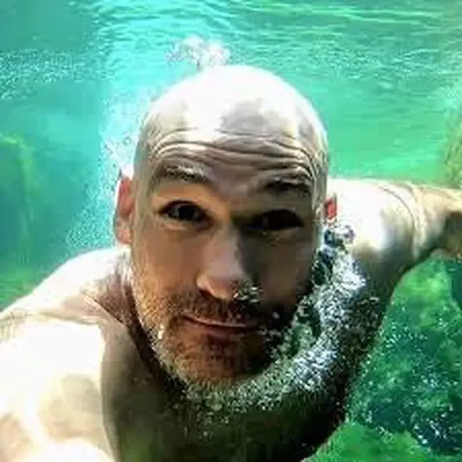
Do you want to know how to find beautiful hidden places? Well in this video, I will show you how to do just that. This is the fourth video in a series where I teach you how to find beautiful hidden waterfalls, swimming holes and other amazing places in nature. In this video, I show you I do research online and all my top tips and tricks to find beautiful secret spots. If you have any questions let me know in the comments below, and the best questions will be featured and answered in one of the final videos of this series.
I make outdoor adventure travel videos to inspire you to take your next trip and get outdoors. Life is short and there are so many interesting people, places and things to learn about and experience. Join me on my journey, SUBSCRIBE AND become a part of Team Infamous.
My name is Jesse St Louis (AKA Infamous JSL) and I'm an actor that likes to go on awesome adventures between gigs. I've been called a "no frills Bear Grylls" but mostly I've been called an Actor. Traveler. Smart-ass.
Welcome back to part four on this series
about how to find beautiful hidden places.
Today is a very unusual style of video for my channel
because we are inside and we are on the computer.
And I normally never make videos like this.
It's a very important video.
Actually, I would say this is probably
the most important video in this entire series.
So if you watch nothing else,
definitely watch this entire video
for all the little tips and tricks
that I'm gonna give you
about how to find hidden beautiful places.
So let's jump in to the research on the computer
and I'll show you exactly what I do to find these places.
Okay, so right off the bat,
the first thing we're gonna talk about is Google Earth.
Now, I have mentioned this before
and it is just amazing the technology
that we have available to us these days.
I mean, Google Earth uses satellites from,
you can see at the bottom here,
these are all the different satellites
that Google Earth uses, NOAA, US Navy, all this stuff.
And so it combines to form just such an accurate
representation and a 3D representation
of the world that we live in.
So if you're not familiar with Google Earth,
it is like Google Maps on steroids.
So let's just dive in here
and check out Southern California,
Santa Clarita.
And so the way that I typically use Google Maps
usually falls into three different categories.
The first category would be if I'm going to an area
that I know has popular spots,
I will kind of scope out around those popular spots
to see what else is in that area.
And you can kind of get a feel for the elevation change.
You can kind of get a feel for it,
like for example, this right here looks like a possible,
just right off the bat,
it looks like a couple of possible pools right here.
But sometimes you get distortion in the satellite.
So you really have to be careful.
And the other thing is you have to take into consideration
what the steepness is to get into some of these areas,
which you can kind of gauge from Google Maps,
but not always 100%.
And that's where a topo map is gonna be
also a good valuable tool.
So you can see this, there's like a ridge line here
and where I just was down here.
I don't even know where I was,
but it looked like there was some interesting stuff
here actually.
So I don't know if those are boulders or what,
but that would be an area that I would explore.
So I'm not even sure where that is.
Angeles National Forest looks like
above Cogswell Reservoir.
The whole reason that I thought there might be stuff
beyond the grotto was I looked on the satellite,
which is what basically,
whenever I refer to satellite imagery,
I'm usually talking about Google Earth.
And I saw, and I think this is actually it right here.
I saw this giant drop right there.
You can see how it looks like a giant drop,
but it's kind of distorted.
But that is like downstream a little further
than the grotto, grotto's up here.
So one of the limitations of Google Earth
is that when there is a lot of vegetation,
it can obscure what exactly you can see.
Although because of the fires out in Malibu
a couple of years ago,
you can see that a lot of that vegetation is gone.
Sometimes in areas where they have deciduous vegetation,
when the leaves are gone during the winter
is a good time to check out for swimming holes
and waterfalls because the trees are barren
during the winter.
And unfortunately, even though the fires are terrible,
they do open up a little bit of what you can see
on the satellite imagery.
So this was this giant waterfall I was trying to get to.
At the time before I made the video,
I didn't know that this was actually private property
beyond here, but you can see it looks like a giant drop.
It's kind of distorted.
Sometimes with the satellite, it distorts it.
So you don't get, I mean,
you can see the kind of the peaks above it,
kind of how it's in this valley here.
You can see it's a steep grade,
but the satellite will distort it.
So it kind of flattens it out a little bit
and you can't always get an accurate representation of it.
I mean, it definitely looks like a giant waterfall.
That was what I was hunting for in that video.
And that's where I got the idea to look for that.
So basically that's what I look for on Google Earth
is stuff like that.
Anything that could be a swimming hole or a waterfall
or maybe even a cave or a boulder grotto,
anything that looks interesting.
And unfortunately, there's not really any kind of hack
to do that simpler.
If I got nothing better to do,
I'll just jump on Google Earth or Google Maps
and just look at the satellite view just to see what I see.
And that's actually how I found a bunch of stuff
up in Sequoia.
Just going down these waterways,
seeing what looks relatively accessible,
because some of this stuff is not.
You know, some of this stuff,
especially when you start going up into Tujunga
and some of these other pretty remote areas
with steeper peaks,
you're talking about more of an expedition
where it would be like a several-day backcountry camping
and bivy and maybe even needing some technical gear.
But just scoping it out, just seeing what you can see.
Not much there right now.
And so that's kind of a crash course in Google Earth.
I mean, you just have to play with it
to get comfortable with it.
And you start to really quickly learn
kind of what is accessible and what isn't accessible.
And you start to learn.
So this is interesting.
This says a spring, Ploughshare Spring here.
So anytime I would see something like that,
I mean, who knows if that's still flowing.
A lot of times you'll see like outdated information.
Los Padres, there's a lot of hidden gems
up in Los Padres.
And you just got to kind of scan it
for something that looks interesting
and then go and check it out.
Oftentimes, like we saw in the case study,
like Kelvin mentioned, in popular areas,
that's where I will start.
So that's why I started with like Circle X
looking over there
because I knew water was flowing at the time.
And you can often get a gauge of water flow
to popular areas from recent Facebook posts
or Instagram posts or something like that.
So that's primarily,
I would say my first line of research is Google Earth.
Now we're talking about water flow.
An interesting thing is you can actually use
the USGS, US Geological Survey,
US Geological Society.
I don't know what it stands for,
but it's a government agency.
And they provide a lot of information.
And they actually have mobile water data
where if you click on an area or a creek,
it will tell you what the water flow is in that area
if it's metered.
Not all of, not every little creek and waterway
is metered by the government,
but a lot of them are.
Oh, so this is Arroyo Seco, actually.
Let's see what they got on there.
Okay, so they have Arroyo Seco,
which is what Switzer Falls is on,
which is what Royal Pool is on.
So let's see what it's got here.
It's got the discharge.
And the most, it's pretty recent, actually,
so they got a gauge on there.
So it's, let's see,
how many discharge cubic feet per second.
So we're up to a little bit of two cubic feet per second.
And in terms of specifics,
I'm not exactly sure how good that is
because I haven't been monitoring stuff
in SoCal for a while,
but you kind of get a gauge for the particular waterway,
like what good flow would be for that waterway
because it really depends on the width
and the size of the drainage and stuff like that.
So it just is a matter of recognizing
the patterns of these waterways.
And if it's a local place near you,
you know, you can write down the information
when it's heavy flow, when it's rain,
you will know whatever that value is.
And then you can go back on this website and compare.
And it's a really handy tool to cross-reference
in combination with Google Maps and Google Earth.
Now, something else from the government,
which actually NOAA National Centers
for Environmental Information,
they have this map.
Now, I'm gonna be 100% honest.
I've only attempted to find one of these one time
and I did make a video about it.
And that one time did not go very well.
But supposedly, this map is all of the thermal springs
in the U.S.
And you can see they rate them over on the left here,
boiling, hot, warm, and they color code them.
Now, I cannot attest to how accurate these are.
The problem with these is
because we have so much tectonic activity in California
and because who knows whenever these were measured last,
it doesn't really tell you that information.
But, you know, according to this,
there is, you know, a hot spring right near,
right near Palos Verdes, 115 degrees,
which is a really hot, hot spring.
And it happens to be in the middle of a golf course.
So, you know, something like that,
they probably like paved over that and built on top of it.
So who knows if that's even there anymore?
Probably not.
But this is just another little kind of aspect of research.
You know, stuff like this is out there.
This gives, you know, so if you wanted to go on a hunt
and track down all of these potential hot springs,
I mean, this is a lot more than the known hot springs
in Southern California.
There's a ton of them here.
So it might be a cool treasure hunt to go check these out
if that's something you're into.
So I'm just showing you the type of information
that you can find online and use for your research.
And the government is a great source
for that kind of stuff.
They also, the government also has
all of the United States topo maps.
Now topo maps are really important
when you want to look for specifics
in terms of elevation change and drainages
and kind of catchment areas
for the creeks that you're going up.
It'll help you determine which drainages look like
they get a higher amount of flow
because they're a larger basin.
They drain several other peaks in the area.
And the good news about these
is I believe you can download these,
you can print them off.
And the thing about topo maps,
there's really two main things about topo maps
that you need to know.
And this is usually the only two things
that I pay attention to are the direction of the water flow
and the elevation change.
So the closer that these lines are together,
that means the steeper the elevation change is.
The direction of the water flow,
basically you want to look at it like,
when it's shaped like this,
like a point, it's kind of like a finger.
Those fingers always point upstream.
So just remember that the finger points upstream
with the topo map.
And if you're looking at a drainage,
wherever the lines are closer together,
that's where you're gonna have a steeper elevation change.
And when you have a steep elevation change like that
with water, you're gonna have a waterfall.
And that's one of the things that I used
in between the first and second trip up that creek
on part one and part two.
I saw that there looked like there were some lines
close together on that creek
and we found some epic waterfalls.
And sometimes, depending on the way the water is flowing,
the lines don't even have to be all that close together
relative to other spots on the creek
and you'll still find waterfalls.
So that's another aspect of research, topo maps.
The next thing I'm gonna talk about are blogs.
Blogs are a tremendous resource, guys.
If you're not reading blogs,
and I'm talking about a lot of different varieties of blogs,
you are missing out.
And to give you an example of just one that I used,
The Hiker's Way in SoCal, he breaks stuff down.
He's got beginner hikes, waterfall hikes, adventure hikes,
and he's got some great hikes on here.
And I've actually done a few of them myself.
He breaks stuff down.
He gives you this interactive map
with where they are located.
Now, I don't think he's updated this in several years.
I think he stopped posting on here,
but it's still a good resource to get an idea of stuff
that is in certain areas.
So if you wanna look for an adventure hike
that he has posted,
you can also scope out areas around those hikes
for other things that maybe he hasn't explored.
And let's see, Allison Gulch, see?
Allison Gulch.
I heard some guy made a video about Allison Gulch Falls.
Dawn Mine.
See, he's posted a lot on here,
but there's still so much more that he's missed.
So it's kind of a good starting point,
especially if you're just getting into
kind of adventure hikes and off-trail bushwhacking
and looking for hidden stuff.
It's a good starting point to jump off from,
like checking out the ones that he has recommended
and then branching off and trying to find your own stuff
that maybe he hasn't recommended.
But just blogs in general are good reading.
And you can find a lot of different options
in terms of blogs.
Just Google search, adventure hikes,
SoCal, something like that.
And his is probably the first one that pops up, yeah.
And then some of these are kind of like the same stuff
that everyone else does,
so you kind of gotta sift through it.
But yeah, there's a ton of good stuff.
California Through My Lens.
A lot of his stuff is more popular,
but that's how I found out about Cave of Munits,
was through his blog.
So a lot of good blogs out there.
And once you've read a lot of these blogs,
you'll see certain patterns develop,
and then you'll start to notice
how you can find stuff on your own
relative to where all these popular spots are.
And that just comes with time and experience.
But definitely blogs are a good way
to kickstart research for an adventure.
Another thing is forums.
And I would recommend this one, icepiratin.com.
It's specific to the San Gabriel Mountains.
And there's a lot of good info on here,
a lot of good trip reports.
And you don't have to post on here,
you can just read.
A lot of the stuff is pretty detailed information,
and you can just read, you don't have to post.
And I would, in fact, encourage you to try and read first,
to answer any questions you have,
other than just jumping on there and asking questions,
like your first post on the site,
just saying, hey, where can I find X?
I would do as much research on your own first,
and even read some posts on the forum
before you're just asking questions.
Because a lot of times in forums,
the questions have been answered multiple times,
and you just have to go looking for them.
And so, let's see, yeah, there is a search function.
And so, I don't know, what would we search?
Airplane wreckage, right?
That's a cool thing to go search for in the mountains.
And I think a lot of, from what I recall, a lot of people,
yeah, see, so Ross Mountain, Alder Gulch,
see, talking about airplane wreckage,
C-46 debris in Punchbowl Canyons.
So whatever you wanted to ask a question about,
or if you're just looking for general stuff,
like abandoned mines, or something like that,
just type it in the search on the Ice Piraten forum first.
And then, and there is like a treasure trove
of information on here that you probably
wouldn't even have to, you know,
ask specifically about, you could just read it.
So that is forums.
Another good forum, I'm not sure that it's still too active
is the Boggly forum, a lot of different stuff,
talking about, you know, hunting, camping,
climbing, canyoneering, all different type of stuff.
And the thing about forums is they really have a forum
for any particular thing you can think of.
And the key to finding hidden beautiful spots
is learning to use a forum in a way
that maybe it's not intended to.
Like for example, one of my buddies, he uses,
I can't remember if it was fly fishing forums,
or creek forums,
in order to find hidden swimming holes.
So he'll go on the fishing forums,
and he's looking for swimming holes,
and hidden waterfalls, and stuff.
And he's utilizing a resource that typically
is only used by these fishermen
to expand his knowledge base
of potential swimming hole areas.
So it's just about getting creative
in terms of stuff like that,
and really there's no limit to the research.
Once you start, I mean, it's really a rabbit hole.
You know, there's all sorts of blogs that are,
you know, people stopped posting like 10 years ago,
but they still have posts up on the blog.
And so this one, this was a blog,
I don't think this guy's posted in a long time,
but he was talking about some hidden falls
up in Matillaha, beyond the Matillaha Falls.
And you can see he's got some amazing pictures here.
And he went, he went all the way up to,
I guess he was calling it the Lost Falls.
This is like a hundred foot waterfall above Matillaha Falls,
but it's quite an adventure.
A hundred foot sandstone face,
terminating in deep blue pool.
So I don't know when this guy posted last.
Probably, probably 2015.
So five years ago was the last time he posted.
I hope he's okay.
But yeah, just get creative.
And once you start learning how to do it,
it becomes that much easier.
And sometimes if you're like me,
you might get obsessed looking for new places.
So guys, that is it.
Those are all of the ways that I research online.
I mean, some of the details are slightly different.
I'm not gonna give you every single blog
that I've ever read.
I'm gonna leave that up to you to find.
But the idea is the same.
You know, just look.
When you're out doing the looky-loo
or the bowl in the China shop,
you gotta go look.
And same when you're doing the research.
And you'll never know what you're gonna find.
And you'd be surprised if you dig deep enough,
you can find amazing stuff.
One last resource I'll mention
that's not kind of digital research
is in-person research.
A lot, pretty much every park ranger I've ever met
at one of the information sites
in a national forest or national park
is super cool.
And they are also a treasure trove of information.
So take advantage of talking to your local park ranger,
forest ranger.
They often have the latest conditions
on where you're trying to go.
They often know a lot of hidden spots as well.
And whether you're cool with them or not,
whether you appear to be a cool person,
they will or will not share those, depending.
And a lot of times as well,
in the park offices,
they will have sometimes older maps.
And these older maps will have on them information
that some of the newer maps don't have,
specifically kind of old waterfalls
and maybe old campgrounds or old spots
that maybe aren't used or not as publicized now
as they were 20 or 30 years ago.
So old maps are also a tremendous way
to find beautiful hidden spots.
I hope you're finding value in this series.
If you have any questions,
drop me a comment down below
because in the final video on this series,
I'm gonna be doing hopefully an intense Q&A
where I answer all your questions
that I have not addressed in this series up till now.
But in the meantime,
get out there, find your adventure and be infamous.
Infamous.